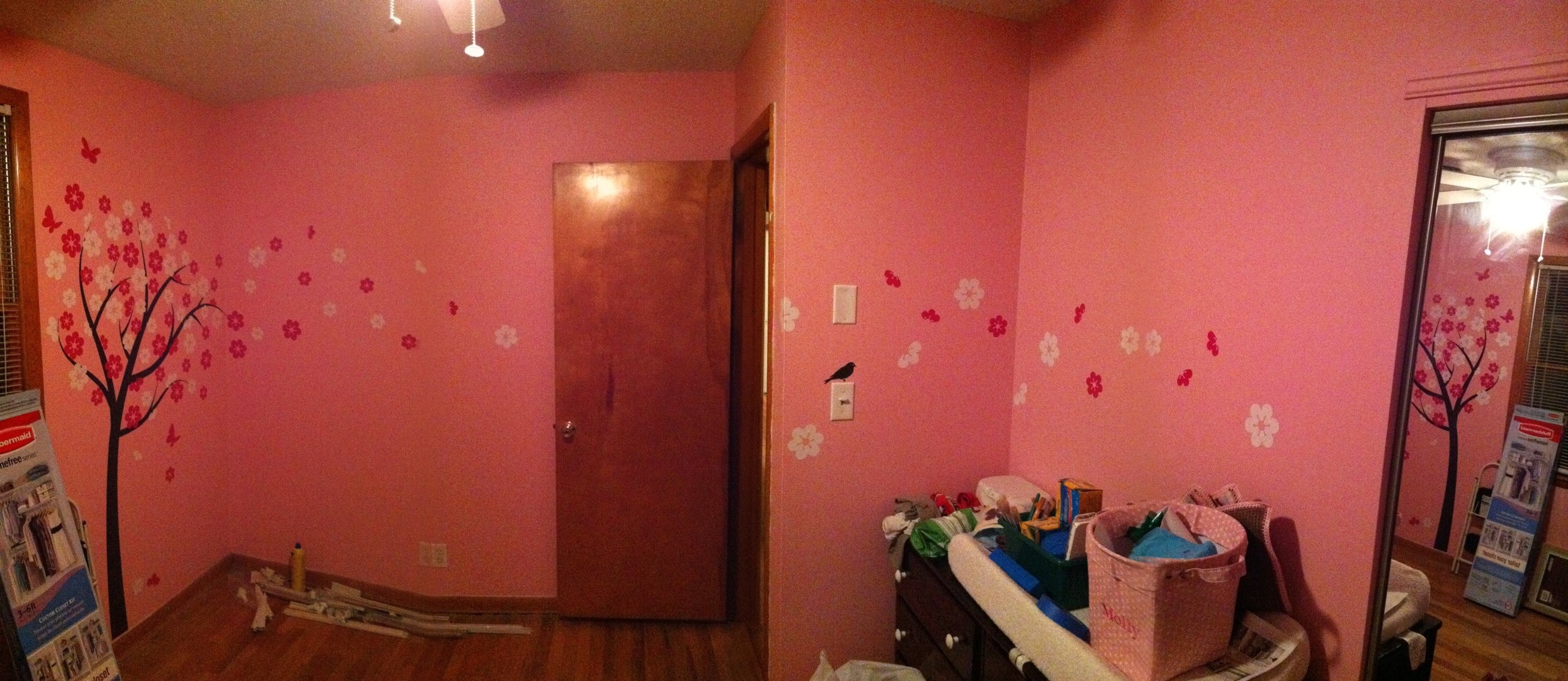
We finally got our wall decal that Kayce ordered… from Israel! It’s really great. But, I cannot tell a lie… This cherry blossom tree was tough to put up. If Joe and Donna hadn’t been here, Kayce and I would’ve had really tough time with it. It’s up and we had enough extra flowers to float them around the corner to the changing table. The picture was taken with a panoramic photo app on my phone.
Month: February 2011
-
360 Degree Snow Photo & WebCam

Click For Full Image I used an app I discovered through James Van Dyke to take this 360 degree photo of the snow at our house today. The app is called Pano, in case your wondering. This was taken with my iPhone4. I almost froze my hands off taking it! Thanks to the iPhone’s capacitive touch screen, which needs bare skin for it to work. Plus, it just takes awhile to take 360 photo. There are few places I could’ve done a better job lining up the previous image, but hey… IT WAS COLD!!Also, I’ve put the “Snow Cam” live. Check it out by clicking SnowCam at the top of the page. It’s a live shot of our street. Enjoy.
-
Weather Channel vs. NWS
Woo hoo!! It’s funny how the national weather service alerts and the weather channels forecast differ. Look at the twc forecast and then read the alert.
…TWO SNOWFALLS ARE EXPECTED IN MIDDLE TENNESSEE THIS WEEK… …THE MID WEEK SNOW STORM COULD BE A BIG ONE… A STRONG COLD FRONT WILL SURGE INTO THE MID STATE ON MONDAY… BRINGING A TURN TO SHARPLY COLDER WEATHER. AS COLDER AIR POURS INTO NORTHWESTERN MIDDLE TENNESSEE MONDAY AFTERNOON…SNOW IS EXPECTED TO DEVELOP AND CONTINUE INTO THE EVENING. THE SNOW WILL THEN SPREAD EASTWARD ACROSS OTHER PARTS OF OUR AREA MONDAY NIGHT…BEFORE TAPERING TO FLURRIES ALONG THE CUMBERLAND PLATEAU TUESDAY. MOST OF THE MID STATE IS EXPECTED TO RECEIVE BETWEEN ONE HALF AND ONE INCH OF SNOW BY SUNRISE TUESDAY…WITH LOW TEMPERATURES TUESDAY MORNING FORECAST TO BE IN THE MIDDLE 20S. SOME ROADS MAY BECOME SLICK AND HAZARDOUS. A COLD CANADIAN AIR MASS WILL SETTLE IN ACROSS THE REGION TUESDAY AND WEDNESDAY…AS A LOW PRESSURE AREA DEVELOPS OVER TEXAS…AND HEADS INTO THE LOWER MISSISSIPPI VALLEY ON WEDNESDAY AFTERNOON. SNOW IS FORECAST TO DEVELOP OVER THE MID STATE BY SUNSET WEDNESDAY…AND INCREASE IN INTENSITY WEDNESDAY NIGHT. THE WAY THINGS LOOK NOW…THE MID STATE HAS THE POSSIBILITY OF RECEIVING SEVERAL INCHES OF SNOW BY SUNRISE THURSDAY. THE SNOW IS FORECAST TO DIMINISH FROM THE WEST ON THURSDAY…BUT ADDITIONAL LIGHT AMOUNTS ARE STILL POSSIBLE. HAZARDOUS DRIVING CONDITIONS WILL LIKELY OCCUR WEDNESDAY NIGHT INTO THURSDAY. ANYONE PLANNING TRAVEL IN THE MID STATE THIS WEEK SHOULD STAY TUNED TO A RELIABLE SOURCE OF WEATHER INFORMATION…AND LISTEN FOR ANY FORECAST UPDATES…OR WINTER WEATHER STATEMENTS…THAT MIGHT BE ISSUED.


